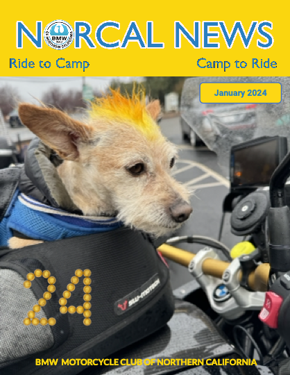
 | Riding and camping Northern California and beyond, since 1965! |

When the Range of Light (RoL) started in 1991, everyone relied on paper for the directions and they were handed out to participants just before the ride. We estimate over 90% of riders now use some form of GPS navigation. The effort to distribute GPS files at the event is significant however more and more individuals are using modern GPS units that can accept files via bluetooth from a phone or other navigation device. We will be providing links via email and QR codes to download route files each day. These route files are electronic versions of the printed route books.
For the 2025 RoL, we will make the following options available at the GPS table on the Friday and Saturday evenings:
- Phone app users (Rever, Gaia, etc)
- Rever routes can be accessed with the QR Codes on the front page of the Route Book. Scan the GPX QR code to access to download routes and tracks for import into your specific app
- Garmin XT/XT2 users
- Download files to your smartphone using the Garmin Drive app and then transfer them to your XT device via Bluetooth
- Other GPS users (inc. Garmin units that do not allow for over-the-air file transfers)
- Copy GPX files from a laptop via USB cable at the GPS Table
- Some Garmin devices can share files peer-to-peer via Bluetooth. See below
- Printed route books will be also be available
Phone Navigation Apps
Before the event, make sure your phone navigation app of choice is up to date including any paid subscriptions if this is required to upload the RoL GPX files. As far as we know all phone navigation apps, with a paid subscription, support the import of GPX files. Scan the GPX QR code on the cover of the route book to access routes and tracks to download. Use GPX Routes at your own direction as we have not validated the routing with any phone app navigation device. To be sure you have an accurate route, rely only on the tracks for uploading to phone apps. Open the Files app on your phone and the GPX file will be in the download section. Select the file and then the SHARE function. Select the specific navigation app that you plan on using and the app should open with the route displayed.
Rever
We have created Rever Routes for both the Road and ADV routes. Your route book will contain QR codes to save the routes to your phone. We recommend you use navigate via follow the line in Rever for the most reliable operation.
Garmin XT – Download via Garmin Drive
For owners of the Garmin XT, it is possible to download GPX files via your smartphone. The following description explains the steps you must take to be able to make this work.
YOU MUST SET UP THE GARMIN DRIVE APP ON YOUR PHONE AND CONFIRM IT IS WORKING WITH YOUR XT BEFORE THE RALLY. Our volunteers won’t have time to trouble shoot your app and if it’s not working you will need to get in-line for a USB download. We strongly recommend that you stay away from, and DO NOT INSTALL, Garmin Explore as this can be overly frustrating to debug at the campground.
Before the rally, install Garmin Drive from the Google or Apple App Store. Garmin Drive allows your phone to connect and transfer GPX files to your XT via Bluetooth. Installation is very straightforward - just follow instructions. As long as Bluetooth is turned on at both devices, they should find each other and, you won’t have to remove the XT from your bike.
Scan the GPX QR Code on the cover of the route sheet to access the route and track directory. Download the specfic file(s) to. your phone. Alternatively head to to the GPS table (starting 5 pm) after registereding for the event to scan the QR code to access and download the GPX files online.
Open the Files app on your phone. The GPX file will be in the download section. Select the file and then the SHARE function. The Garmin Drive app will show up as a SHARE option. Select the Garmin Drive app and the app should open. (It maybe that on your phone the Garmin Drive App will open immediately on selecting the GPX file). Stand close to your Garmin XT, make sure Bluetooth is enabled on both the phone and the XT.
A Garmin Drive window will pop up saying “GPX File Received”, select “Send” and you are done.
On the Garmin XT to see the route go to Apps -> Trip Planner -> Saved trips and you may see the route already. If not then select wrench symbols in the top left corner, then select import. All downloaded GPX files should show here. Select the one you want to import to Trip Planner. The route GPX file is then converted into a form that the GPS unit can perform turn by turn navigation and will show under Trip Planner -> Saved Trips. Note that your GPS device will re-calculate the route using the device’s own map, which can result in slight variations from unit to unit depending on your map.
We have found that the route calculation is most consistent across devices if you select the “Shortest Distance” option.
Everyone who owns a Garmin XT is encouraged to follow the above instructions and get familiar with the process. It is the easiest and fastest way to upload GPX files.
Other GPS Devices – Manual Download via USB
This is the same process that we have used in the past. We suggest you bring your own USB cable just in case your device has an older or different plug type. Furthermore, it is highly advised you also TEST YOUR CABLE with you GPS before arrival, as some USB cable are power only and do not support data.
At the Rally, go to the GPX table (starting 5 pm) and show your wristband. A volunteer will plug your device into a laptop and download the files. This is easy but the line could be long, so be patient! Check out this Video for what to do after the file is transferred to your device
Route Sharing Between Garmin GPS
Club and Event Rules REQUIRE all riders register and sign the AMA liability waiver,
individuals who have not signed the waiver cannot participate and will not have a wristband.
Please do not use this file sharing option to give files to anyone who does not have a wristband.
Riders with wristbands that have compatible devices can save a lot of time by sharing routes with each other.
Route Sharing over Bluetooth is a Garmin feature supported on the following devices
The two Garmin need to be turned on, Bluetooth enabled, and be in fairly close proximity. On the Garmin that already has the GPX file installed, open the route to be shared in Trip Planner. Then Select the wrench symbol in the top left-hand corner and then select Share. Select Bluetooth. Then follow instructions on both sending and receiving GPS.
CarPlay & Android Drive (Scenic, Google Maps, Apple Maps)
Limited support is currently offered for these apps at this current time, though they do work and several members are using these solutions as their primary navigation aids. It is suggested that members looking into this option consult with other members for the time-being.
A nice article on Scenic was offered in the club magazine in the 2024 February edition